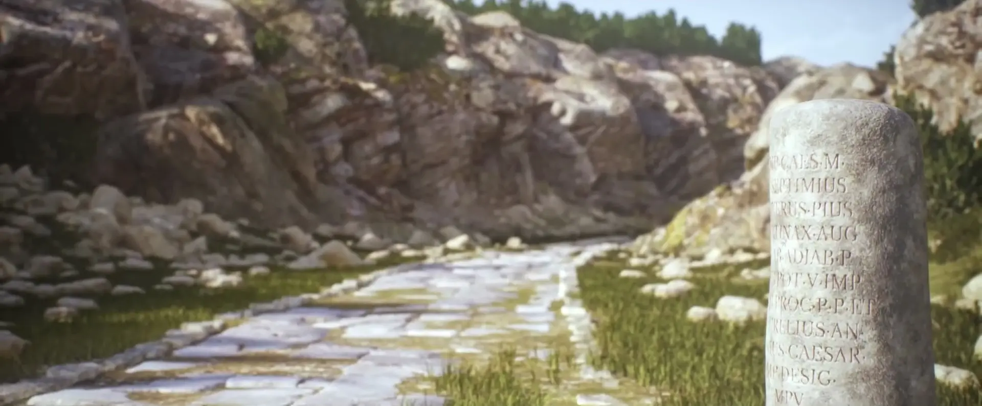
Itiner-e digitally reconstructs nearly 300,000 km of Roman roads, doubling previous estimates and delivering the most complete map of the ancient network ever made, built from 200 years of research layered with modern data. Every road segment was manually mapped with varying levels of certainty, revealing a far more realistic web of main routes, winding paths, and local roads, essentially a Google Maps for Ancient Rome.
The result transforms our understanding of the Empire: military movements, trade flows, cultural diffusion, and untouched mysteries, all open for the public to explore and enrich.
“All roads lead to Rome” is more than a saying, it’s a question historians have chased for centuries. Where exactly did those famous roads go? What did the Empire’s sprawling transportation system truly look like? And how did it shape Europe, the Middle East, and North Africa?
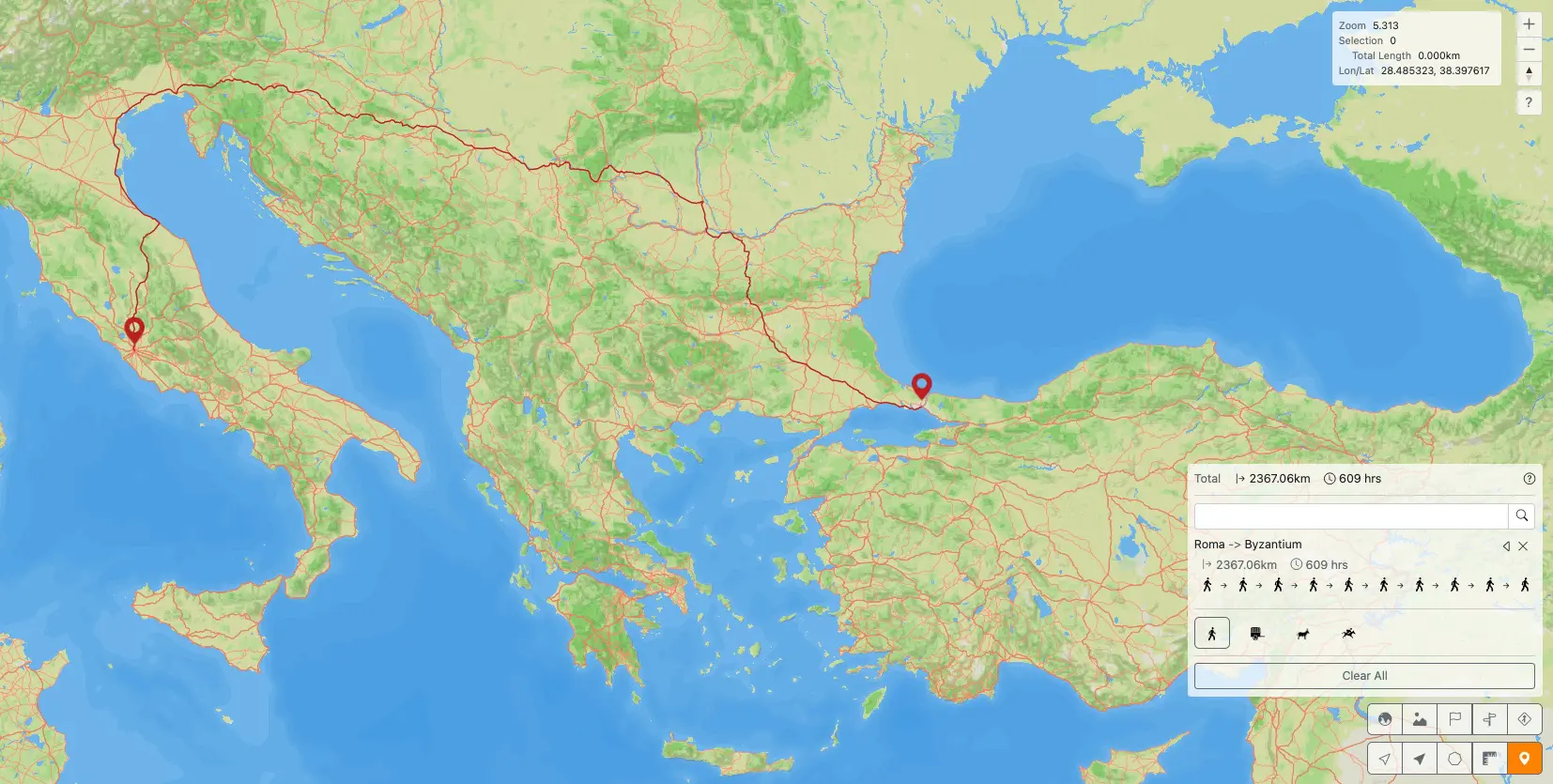
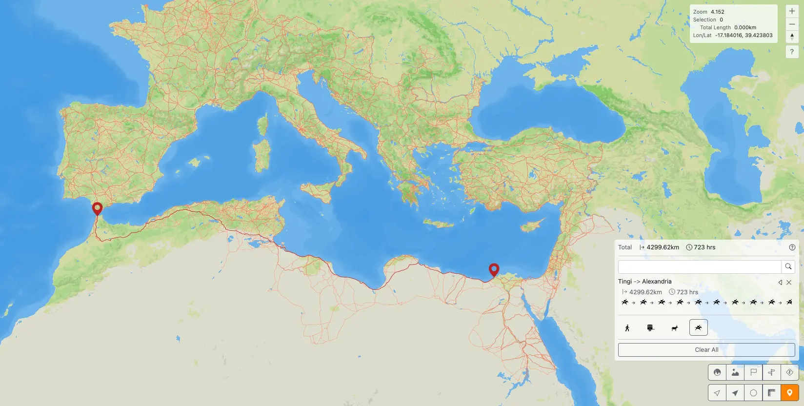
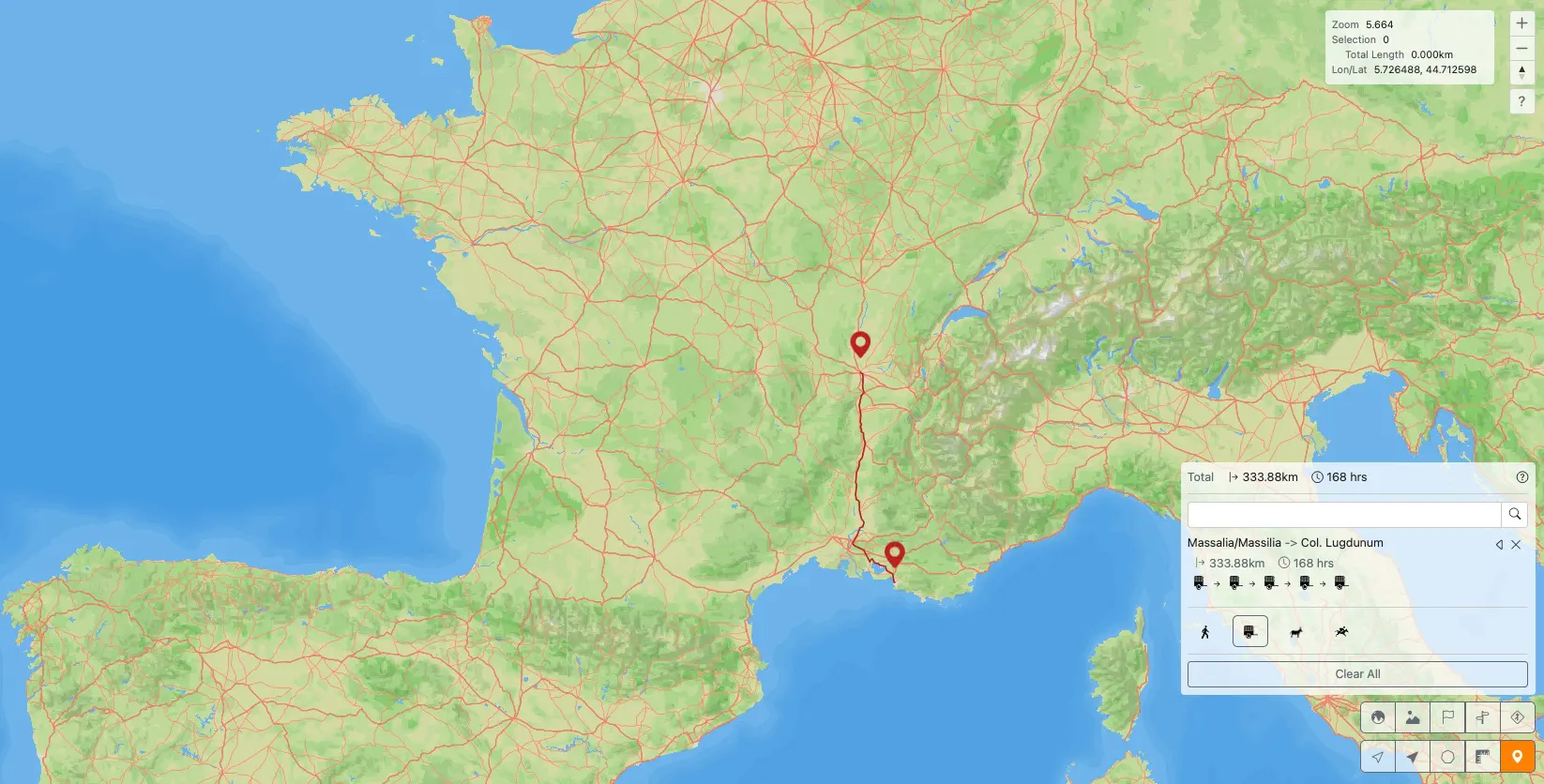
A new project called Itiner-e finally answers that. It’s the most complete digital map ever created of the Roman road network, a massive reconstruction of almost 300,000 kilometers of ancient routes that completely reshapes what we thought we knew about the Empire’s geography.
Built from two centuries of archaeological evidence, ancient texts, Latin inscriptions, and even Cold War satellite imagery, Itiner-e offers a stunningly detailed look at the world as it was around 150 AD. Think of it as a “Roman Empire mobility OS” and it’s now publicly accessible.
A Map That Doubles Our Knowledge of Rome’s Roads
Until now, the most reliable estimates put the Roman network at roughly 188,000 km. Itiner-e pushes that to 299,171 km, a huge jump made possible by a methodological first: pulling together every known reference, from text fragments to regional studies, and cross-checking them against aerial photos and modern satellite scans.
The result is a network that finally looks human: no more straight lines drawn for convenience, but roads that curve around mountains, wind through valleys, and adapt to terrain.
The map also separates primary administrative and military routes from secondary roads, a fascinating window into everyday provincial life.
A Scientific and Technological Feat
Behind the sleek map sits painstaking work: every single segment was manually digitized at 5–200m precision to match real-world topography.
The project is refreshingly transparent, too:
- 2.7% of routes have confirmed locations
- ~90% are “conjectural,” reconstructed from multiple converging clues
It’s a realistic acknowledgment that much of the Roman world remains hidden, and an invitation to keep digging.
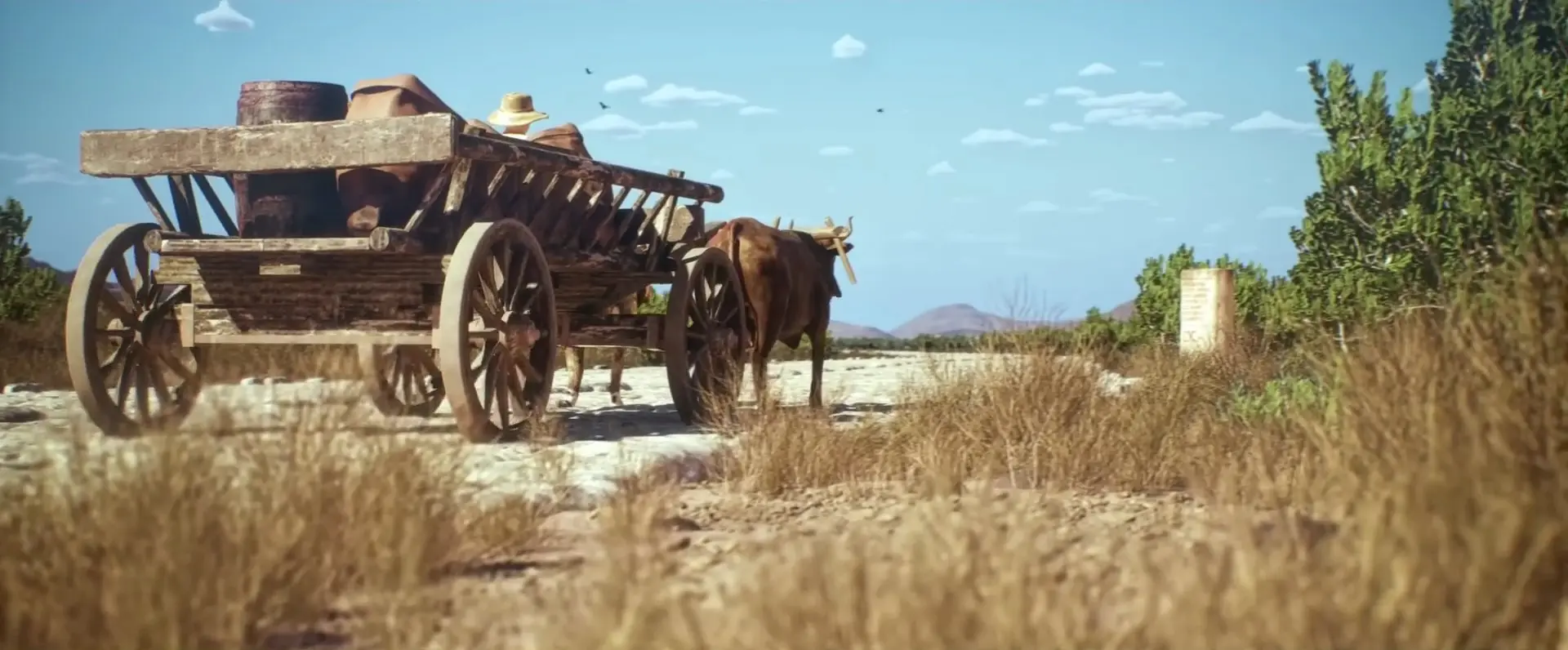
At itiner-e.org, anyone can explore the map in high resolution, compare it to modern borders, trace routes on foot, horseback, or ox cart, or even see how long it took a soldier to reach an outpost. For the first time, we can observe the daily machinery of an empire at the scale of its roads.
A New Way to Read the Roman Empire
Beyond the technical achievement, Itiner-e helps reopen essential questions about how Rome truly functioned. These roads carried legions, merchants, ideas, religions, and diseases. They reveal economic corridors, cultural movements, political control, and even vulnerabilities leading to Rome’s decline.
The map also exposes major gaps in our knowledge: Tuscany, Corsica, central Anatolia, and parts of Britain remain under-documented, reminders of how much we still don’t know. And that’s the point.
Itiner-e isn’t the final word, it’s a living, collaborative platform inviting archaeologists, researchers, and history lovers to help rebuild the most influential transportation network in human history.
Also Read:
Discord Now Lets You Buy and Gift Video Game Skins, Starting With Marvel Rivals
Loveholidays Built a Beach Inside a Billboard, Complete With a Real Sunbather
Stranger Things x Burger King: a Secret Menu You Unlock by Flipping Your Phone