Google Maps announced it’s rolling out street-level details – like crosswalks, sidewalks, and more, in four major global cities.
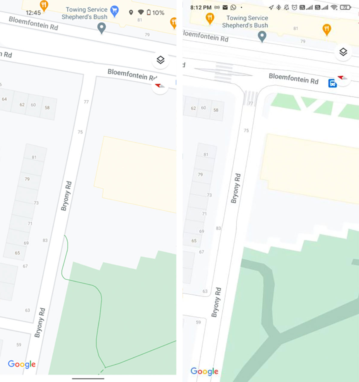
Late last summer, Google Maps announced that it would be bringing a lot more detail to street level on its app, and we started seeing the beginning of this in December. Now, the street-level details in question – crosswalks, sidewalks, accurately scaled road widths, pathways and stairs in parks, as well as medians and pedestrian islands – are appearing for four major cities around the world.
Related | Google Now Has A Guest Mode On Its Smart Speakers
The changes are still rolling out, so you might not see them yet, but you’ll be able to see them in maps of London (Central London), New York City, San Francisco, and Tokyo (Central Tokyo). You can check to see if you have the updated maps by zooming in on these cities at street level.
Parks will display the true width of pathways in green, and stairs in grey, letting users find the best way to get from A to B.
For the time being, the feature is only available in maps of the aforementioned cities – and there is no evidence to suggest other cities will roll out soon.