Google Maps can now show you directions using rented bikes from bike-share schemes in major cities around the world, like London or New York.
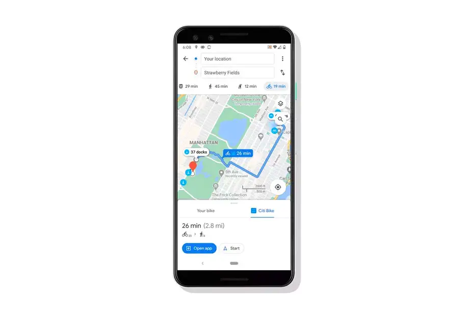
If you have used Google Maps to cycle your way through the city using bike-share schemes like Citi Bike in New York or Santander Cycles in London, you will know the pain: where can you dock your bike back once you have reached your destination?
Related | Google Maps Helps You Find More Delivery And Takeout Options
Starting today, Google Maps will offer complete end-to-end cycling routes for bike-share users in 10 cities around the world: Chicago; New York City; the San Francisco Bay Area; Washington, DC; London; Mexico City; Montreal; Rio De Janeiro; São Paulo; and Taipei and New Taipei City — with more cities to be added in the coming months.
It works by giving walking directions to a nearby bike-share dock, cycling directions from there to another dock near your destination, and finally walking directions to your final destination. The new feature builds on Google Maps’ existing relationship with Ito World that lets you find docked bikes available for use, where available.
End-to-end routes for bike-share users arrive as cities across the world are pushing for people to consider bikes as the best, most environmentally friendly, solution to commuting. And of course, cycling is also an easier way to ensure you are socially distancing during the on-going COVID-19 pandemic.
In fact, Google says that it has seen a 69% increase in requests for cycling direction on Google Maps since the beginning of the pandemic.